In 2015, PASCO partnered with Esri, the world’s leading provider of geographic information system (GIS) software to bring real-time mapping into science and STEM courses. Incorporating their technology, ArcGIS, into our data-collection software, SPARKvue, enables teachers and students to expand data sets by visualizing them using interactive geospatial technology.
Data mapping plays a critical role in science, as it allows us to explore and analyze complex data sets in a simple yet profound format. Researchers worldwide use GIS mapping to identify patterns, correlations, and trends that are otherwise invisible by stacking multiple data points on top of each other. In the classroom, GIS allows students to become researchers themselves by analyzing data geographically and creating connections between textbook material and the outside world. What better way to train the next generation of scientists than to use modern technology to make science applicable to their own backyards?

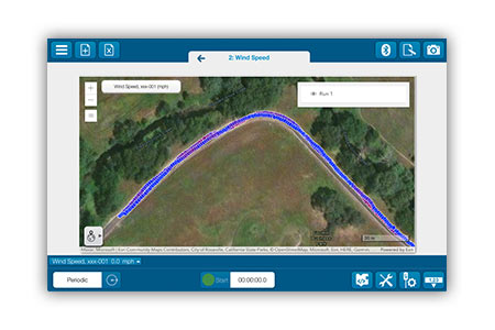
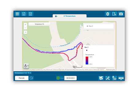
Map measurements as they’re made with the SPARKvue Map display.

Gain insights into local habitats, water quality, and more.
With Esri on board, we’ve stepped our favorite sensors up a notch. Choose any of our Wireless Sensors, from pH to Temperature to Carbon Dioxide, and pair it with GPS data from your smartphone to map measurements in real time. Other sensors, like our Wireless Weather Sensor with GPS, are already equipped to collect GPS data as you move. Choose from a selection of high-quality basemaps to display your data points, ranging from a classic grid map to a modern, three-dimensional layout. Esri also makes it easy to import information directly into ArcGIS where students can layer multiple variables for an in-depth look at their surroundings.
With PASCO and Esri, educators can engage students in authentic science investigations using modern tools and technology that mirror those used by scientists around the world.

